Geospatial Data Specialist
Share
Zionsville, IN - USA
Job Summary
Compensation
$25.00 HourlyJob Description
Location: Zionsville IN
*Hybrid options potentially in the future
Company Overview
The law requires you to call 811 to have public utilities marked before you dig. However public utilities will only locate the facilities they own electric gas oil sewer telephone and water. The vast majority of underground utilities are privately owned which is why you need to make Blood Hound your second call.
Blood Hound locates ALL underground utilities and structures and offer a range of highly specialized subsurface utility services to significantly reduce your risk of costly damages and project delays and mitigate safety hazards for your crews and community.
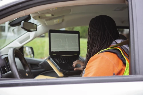
Blood Hounds Geospatial Division is leading the evolution of utility mapping and subsurface data collection. Our work combines Multi-Channel GPR UAS LiDAR mobile scanning and advanced GIS tools to deliver high-resolution 2D and 3D mapping data for engineering and construction clients nationwide.
Summary
Blood Hound is seeking a detail-oriented and technically skilled Geospatial Data Processing Specialist to join our expanding Geospatial Division. This role is focused on transforming raw sensor dataGPR LiDAR GNSS and UAS imageryinto precise client-ready deliverables that power engineering design and construction decisions.
Youll work closely with our Geospatial Systems Supervisor CAD and GIS teams and field crews to ensure that data captured in the field is processed organized and delivered with the highest accuracy and consistency.
This role is ideal for someone who enjoys data analysis mapping workflows and precision quality control across a wide variety of datasets and software platforms.
Responsibilities
- Process and organize geospatial datasets from multiple sensors including LiDAR GPR GNSS and photogrammetry.
- Perform QA/QC checks to ensure alignment completeness and consistency across all collected data.
- Convert and clean datasets for import into CAD GIS and BIM environments (Civil 3D QGIS Revit etc.).
- Generate 2D and 3D outputs such as shapefiles DWGs KMLs and surfaces/TINs.
- Standardize naming conventions coordinate systems and metadata across project deliverables.
- Collaborate with the Geospatial Systems Supervisor to improve internal data pipelines and automation.
- Support the creation and maintenance of libraries templates and standard processing documentation.
- Ensure data is properly archived and backed up according to company protocols.
- Communicate regularly with field teams to clarify data collection parameters and resolve inconsistencies.
- Provide feedback to technicians and supervisors to enhance data capture quality and efficiency.
- Support managers and CAD/GIS staff with organized and verified datasets ready for drafting or analysis.
Requirements
- 25 years of experience in geospatial data processing remote sensing or GIS/CAD production.
- Proficiency with AutoCAD Civil 3D QGIS or similar mapping software.
- Familiarity with LiDAR photogrammetry or GPR data formats and workflows preferred.
- Understanding of coordinate systems datums and transformations.
- Strong organizational skills and attention to detail.
- Experience with data QA/QC or file standardization.
- Bachelors degree in Geography Geomatics Engineering Technology or related field preferred (or equivalent experience).
- Comfortable learning new processing tools and adapting to evolving technology.
We are an Equal Opportunity Employer. Veterans are encouraged to apply.
Required Experience:
IC
Key Skills
- GIS
- Computer Data Entry
- Facilities Management
- ADMA
- Fleet
- Key Account
About Company
USIC is North America’s largest provider of underground utility damage prevention services, performing more than 80 million locates each year, and an emerging leader in advanced utility services and solutions. We are committed to providing the highest quality services, and safety is a ... View more
